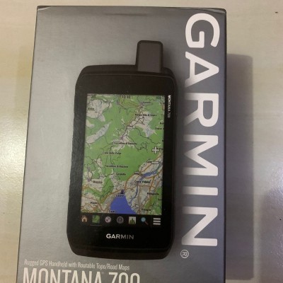


Garmin Montana 700 - GPS Survey Layar Sentuh#081289854242
Perhatian!
Spesifikasi Garmin Montana 700 - GPS Survey Layar Sentuh#081289854242
General
Physical dimensions 3.4" x 7.2" x 1.3" (8.76 x 18.30 x 3.27 cm)
Touchscreen
Display size 2.55"W x 4.25"H (6.48 x 10.80 cm); 5" diag (12.70 cm)
Display resolution480 x 800 pixels
Display type WVGA transflective, dual orientationWeight14.0 oz (397 g) with included lithium-ion battery pack
Battery type rechargeable lithium-ion (included) or 3 AA batteries (not included); lithium recommended
Battery life GPS Mode: up to 18 hours
Expedition Mode: up to 330 hours
Water rating IPX7MIL-STD-810 yes (thermal, shock, water, vibe)High-sensitivity receiver Interfacehigh speed micro USB and NMEA 0183 compatibleMemory/History16 GB (user space varies based on included mapping)
-
RUGGED BY DESIGN
This durable, water-resistant handheld is tested to U.S. military standards and features a glove-friendly 5” touchscreen that’s 50% larger than previous Montana models.
TOPOACTIVE MAPS
To navigate your adventures, use preloaded topographical maps for the U.S. and Canada. View terrain contours, elevations, coastlines, rivers, landmarks and more.
SATELLITE VIEWS
Use direct-to-device downloads of BirdsEye Satellite Imagery (no annual subscription required) to see photo-realistic views and create waypoints based on landmarks.
LOCATION SHARING
The LiveTrack feature lets you wirelessly connect1 your device with other compatible Garmin GPS users, so they can follow your tracks, routes, waypoints and adventures.
-
Maps & Memory
Preloaded maps yes (TopoActive, by region; Federal Public Lands maps, U.S. only)
Ability to add maps
basemap Automatic routing (turn by turn routing on roads) for outdoor activitiesYes (with optional mapping for detailed roads)
Map segments 15000
BirdsEye: yes (direct to device)
Includes detailed hydrographic features (coastlines, lake/river shorelines, wetlands and perennial and seasonal streams)
Includes searchable points of interests (parks, campgrounds, scenic lookouts and picnic sites)
Displays national, state and local parks, forests, and wilderness areas
External memory storage yes (32 GB max microSD card)
Waypoints/favorites/locations 10000
Tracks 250
Track log 20000 points, 250 saved gpx tracks, 300 saved fit activities
Routes 250, 250 points per route; 50 points auto routing
Rinex logging
Sensors
GPS
GLONASS
Galileo
Barometric altimeter
Compass Yes (tilt-compensated 3-axis)
GPS compass (while moving)
Daily Smart Features
Connect IQ (downloadable watch faces, data fields, widgets and apps)
Smart notifications on handheld
VIRB Remote
Pairs with Garmin Connect Mobile
Active Weather
Safety and Tracking Features
LiveTrack
Outdoor Recreation
Point-to-point navigation
Compatible with baseCamp
Area calculation
Hunt/fish calendar
Sun and moon information
XERO Locations
Geocaching-friendly yes (Geocache Live)
Custom maps compatible yes (500 custom map tiles)
Picture viewer
inReach remote widget
LED beacon flashlight
inReach Features
inReach remote compatible
Outdoor Applications
Compatible with Garmin Explore app
Garmin Explore website compatible
Dog tracking yes (when paired to compatible dog track system)
Connections
Wireless connectivity yes (Wi-Fi, BLUETOOTH, ANT+)
Isi dalam Kotak:
Montana 700
Lithium-ion battery pack
USB cable
documentation
NUSATAMA STORE :
Jl.H.Sapri No.123 Pondok Aren Tangerang Selatan 15224
Untuk informasi Stok Barang & Harga Terbaru, silahkan hubungi Sales Support kami melalui kontak berikut :
Telepon : (+62) 21 – 2756 4609
WhatsApp : 0812 8985 4242 – 0817 675 5161
PanduGeologis
Sudah banyak perusahaan besar yang menjadi pelanggan tetap kami, dan kami akan terus berusaha mempertahankannya. Untuk beberapa pelanggan, kami juga menyediakan keperluan mereka lainnya sesuai permintaan mereka diluar display produk yang tertera di website kami untuk memudahkan mereka dalam mencari keperluan mereka.
Kami akan terus meningkatkan kualitas kami sebagai Penyedia keperluan para pelanggan dengan berbagai kemudahan yang bisa anda dapat sebagai pelanggan kami. Kami siap bersaing dalam hal pelayanan, harga dan purna jual demi kepuasan anda sebagai pelanggan.
Salam,
Nusatama Survey