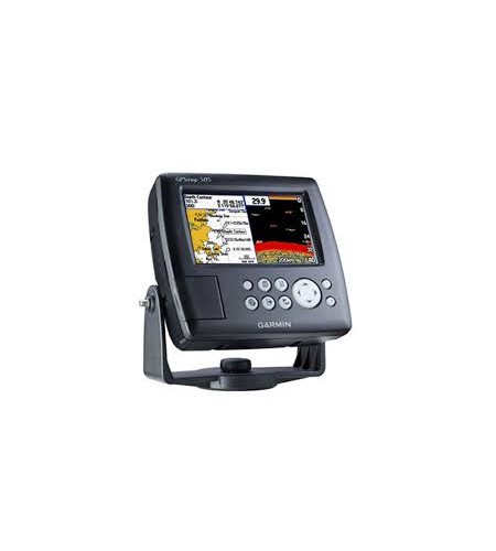
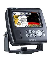

GPS Garmin Marine 585
Perhatian!
Spesifikasi GPS Garmin Marine 585
Detail Produk GPS Garmin Marine 585
Product description GPSMAP 585 is a full-function chart plotter that features an ultra-bright 5” WQVGA color display along with an improved feature of high-speed map drawing and panning. It’s ready to go with an easy-to-use interface and a built-in worldwide basemap. The 585 is unique Garmin chart plotters that not only equip with English language but also with Asian languages including Simplified Chinese and Bahasa Indonesia. GPSMAP 585 is designed specifically for professional fishermen and comes with the advantages of Garmin’s renowned GPS168/178C chart plotters. What’s more, you can now fish with a high quality chart plotter at more affordable cost.
Explore the Seas
The GPSMAP 585 comes standard with a built-in high-sensitivity GPS module for superior satellite tracking and quicker acquisition times. And with a SD card slot, it’s easy to add additional maps without connecting to a computer.
Add Sonar
Where applicable, the sounder version, GPSMAP 585, comes with optional transducer that can clearly illustrate depth contours, fish targets and structures. Whether you’re fishing in freshwater or off the coast, you can always find right Garmin transducers of various kinds to suit your needs. The GPSMAP 585 is also NMEA 0183 compliant for connectivity with sensors, instruments and future marine offerings.
Physical & Performance: |
|
| Unit dimensions, WxHxD: | 5.9″ x 6.4″ x 2.9″ (15.0 x 16.3 x 7.4 cm) |
| Display size, WxH: | 5”, 120.7×75.8mm |
| Display resolution, WxH: | 480×272 pixels |
| Display type: | WQVGA |
| Weight: | 390g |
| Waterproof: | yes (IPX7) |
Maps & Memory: |
|
| Basemap: | yes |
| Preloaded maps: | no |
| Ability to add maps: | yes |
| Accepts data cards: | SD card slot |
| Waypoints/favorites/locations: | 6000 |
| Routes: | 150 tracks/250 points |
Features: |
|
| CANet® compatible: | no |
| Supports AIS (tracks target ships’ position): | yes |
| Supports DSC (displays position data from DSC capable VHF radio): | yes |
| Audible alarms: | yes |
| Tide tables: | yes |
| Sun and moon information: | yes |
| 3-D map view: | no |
| Dual-frequency sonar capable: | yes |
| Dual-beam sonar capable : | no |
| Split-screen zoom: | yes |
| Split-screen sonar/gps: | yes |
| Ultrascroll™ (displays fish targets at higher boat speeds): | yes |
| See-thru® technology (exposes fish hidden in cover): | yes |
| Fish Symbol ID (helps identify fish targets): | yes |
| AutoGain Technology (minimizes clutter, maximizes targets): | yes |
| Whiteline (indicates hard or soft bottom): | yes |
| Adjustable depth line (measures depth of underwater objects): | yes |
| A-scope (real time display of fish passing through transducer beam): | yes |
| Bottom lock (shows return from the bottom up): | yes |
| Water temperature log and graph: | yes |
| Water temperature sensor included: | yes (need to equipt with correct tranducer) |
Sonar: |
|
| Frequency: | 50/200 kHz |
| Transmit power: | 500W(RMS), 4,000W(peak to peak) |
| Voltage range: | 10-36 VDC |
| Maximum depth*: | 1,500ft |
| Cone angle: | 20 degrees |
| *Depth capacity is dependent on water salinity, bottom type, and other water conditions. | |
Mitra Geologi


Produk Lainnya


Brica B-Steady Series - BSteady Q -
Rp. 389.000

Tefal Day by Day Deep Frypan Series
CALL
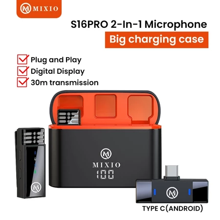
MIXIO S16Pro Mic Wireless Microphone
Rp. 293.000
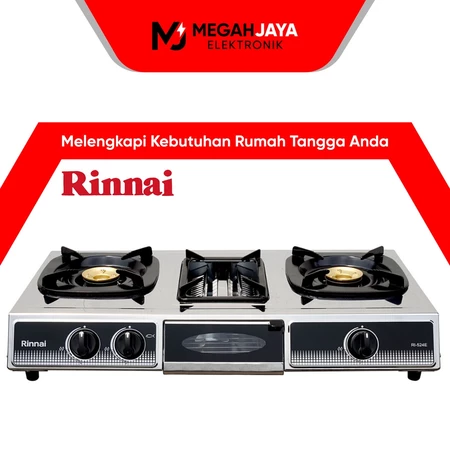
RINNAI KOMPOR STAINLESS STEEL + GRIL
Rp. 830.000
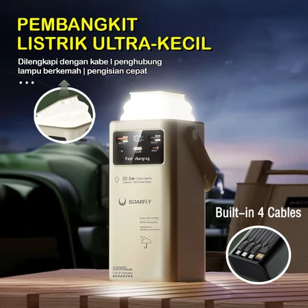
60000mAH Ultra Capacity Power Bank 2
Rp. 203.000