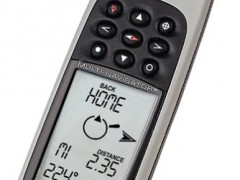
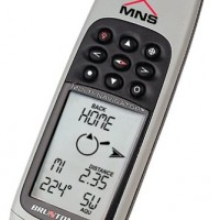

BRUNTON MNS Multi-Navigator
Perhatian!
Spesifikasi BRUNTON MNS Multi-Navigator
BRUNTON MNS Multi-Navigator
Global Position System / TrueMagnetic™ Digital Compass / Barometer-Altimeter
The Brunton MNS Multi-Navigator is more than just an ordinary Global Positioning System. It is the only instrument you will need to head into extreme unknown territory and return home safely. Whether fighting your way through tropical rain forests or blazing new ground in the Arctic, the Multi-Navigator is designed to withstand the most extreme weather conditions.
Unlike standard GPS units the MNS incorporates two integrated navigation devices with a GPS receiver, and combines this with a durable and waterproof body and the most temperature resistant LCD screen on the market.
The TrueMagnetic Compass
The internal digital compass automatically adjusts for local declination and continues to show the true compass course during navigation. The compass function also works independently of the GPS function, allowing you to navigate without the assistance of satellites and update your position with the GPS only when needed.
This unique feature allows for amazing battery conservation; giving you weeks worth of battery power rather than hours. And unlike a regular GPS where you have to be moving to obtain a directional bearing, the Multi-Navigator can obtain a bearing while you’re standing still, an invaluable feature when motion is not an option.
The StraightHome feature
Integrating a TrueMagnetic compass allowed us to add the one-button StraightHome™ Feature making the Multi-Navigator stand even further apart from other GPS units in the marketplace. Now the user can easily access a direct bearing to a stored HOME position, eliminating the need to retrace the entire route on the return trip. This feature can be particularly helpful in an emergency situation as it provides an immediate bearing to safety.
The Stormwatch Barometer
The Multi-Navigator provides current barometric pressure and the history for the past 36 hours. The forecast for the upcoming 12 hours is displayed on the easy-to-read LCD screen in Sunny, Partly Cloudy, Rainy, and Storm Warning connotations.
The Internal Altimeter
Reads elevation based on atmospheric pressure, not satellite signals. Where other GPS units are capable of detecting altitude with an accuracy of +/- 30 feet, the Multi-Navigator can provide an altitude reading accurate to 3 feet, making it an invaluable navigation aid for pinpointing your exact position.
More than your typical GPS reciever
The unique Brunton Multi-Navigator is unrivaled by any other navigational instrument available, providing all of the necessary features you will every need to keep an eye on your position, direction and weather conditions. Guaranteed to make your outdoor adventures more rewarding, the Multi-Navigator tells you not only where you are but where to go, when and why.
MNS Specifications
GPS Receiver
• 12-channel parallel receiver
• Position update rate: 1 time per second - When in continuous navigation mode
• Accuracy: 15 meters RMS.
• Averaging
• Time To Fix: First Time - approx. 1-2 minutes
• Cold (no navigation for 4 hours) - approx. 45 seconds
• Reacquisition (lost satellite reception) - approx. 0.1 seconds
• Antenna: Built-in patch antenna
• Waypoints: 1,000 w/ 8-Character name (stored w/ barometric pressure based altitude)
• Routes: 10 Reversible routes w/ up to 100 waypoints each
• Track logging: 5000 additional track log positions. Automatically records your track by time or distance and stores for display using mapping software
• 109 Map Datums
• 16 Grid Systems including UTM, MGRS, Swiss, Australian, New Zealand, Swedish and United Kingdom grid systems
• StraightHome™: A simple one button find your way back home, for the simplest navigation
Data I/O
• NMEA 0183 - Out · Nexus point to point - in/out · DGPS ready
TrueMagnetic™ Compass
• Accuracy: to 2° w/ 1° resolution
• TrueMagnetic™ Compass: Automatically compensates for Earth's local magnetic declination and points you in the direction of a stored waypoint, without moving
• MagniPointer™ fast "point & press" waypoint creator
• Extended battery life when using the TrueMagnetic™ compass with GPS receiver off
StormWatch Barometer
• Current pressure (Units: inHg, mmHg, mbar, hPa) -- Displays rising, falling & steady
• Barometric pressure range: 300 to 1100 mbar (9.00 to 33.00 inHg)
• 36 hour pressure history
• 12 Hour weather forecast (Display: Sunny, Partly Cloudy, Cloudy, Rainy, Storm Warning)
• Logging performed when power is OFF
• Accuracy: Down to 1 meter (3 feet) - Immediately after calibration
• Altitude range: -700 to +9200 m (-2,300 to + 30,000 ft.)
• Memory: Minimum and Maximum altitude visited
• Displays rate of change and minimum & maximum
Battery Life
• Typical compass navigation: Up to 60 days (using compass with GPS receiver off)
• Typical compass & GPS navigation: Up to 100 hours (one GPS receiver update per hour with compass navigation every 5th minute, continuous barometer logging)
• Continuous GPS navigation: up to 10 hours
• 170 x 61 x 30 mm (6.7 x 2.4 x 1.2 inches)
• Display Size: 6.1 x 4.4 mm (2.4 x 1.7 inches)
• Weight (excluding batteries): 227 g (8.0 oz)
• Optimal operating temperature range: -25° to +70° C (-13° to +158° F) using Lithium batteries
• Waterproof: IP65
• Display: 24 character, high-contrast, back-lighted LCD
• Keyboard: 9 Buttons - back-lighted
• Internal power: Qty. 2 AA batteries (LR6)
• External power: 8 - 30 VDC
• Flash memory: upgradable software
• Operational in 13 languages
Digital Instrument
Selamat Datang Di
Digital Instrument - Industrial Equipment Online Store
Industrial Equipment - Menjual Berbagai Macam Peralatan Kebutuhan Industri Seperti :
Surveying : Total Station, Digital Theodolite, Automatic Level / Waterpass, Hand Level, Measuring Tape, Measuing Wheel, Laser Distance Meter, Range Finder.
Geology Tools : Compass, Clinometer, Rain Gauge, Altimeter, Palu, Current Meter.
Global Positioning System ( GPS) : Navigation, Aviation, Marine, Sport, Handheld, Geodetic dan Mapping.
Electrical Test Tool : Clamp Meter, Multimeter, pH Meter, Vibration Meter, Sound Level Meter, Light Meter, Thermometer, Anemometer, Tachometer, Oscilloscope, Spectrum Analyzer, Power Supply, Frequency Counter, Function Generator, Audio Generator, Signal Generator.
Communication : Handy-Talkie, Repeater, Satelite Phone.
Teropong : Binocular, Monocular, Telescope, Microscope.


Produk Lainnya

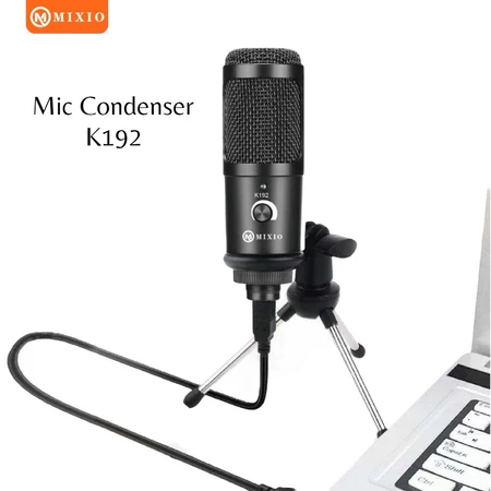
MIXIO K192 Mic Microphone Condeser S
Rp. 185.000
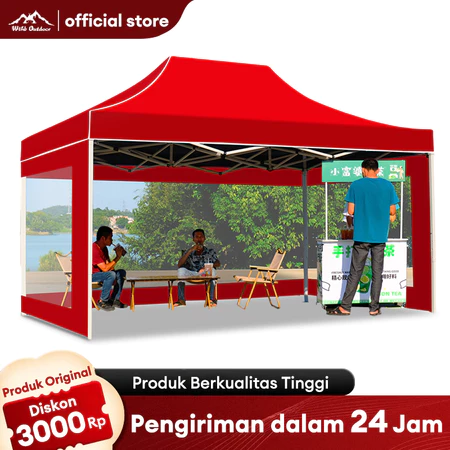
Tenda Pedagang Tenda Jualan Lipat 2x
Rp. 518.000
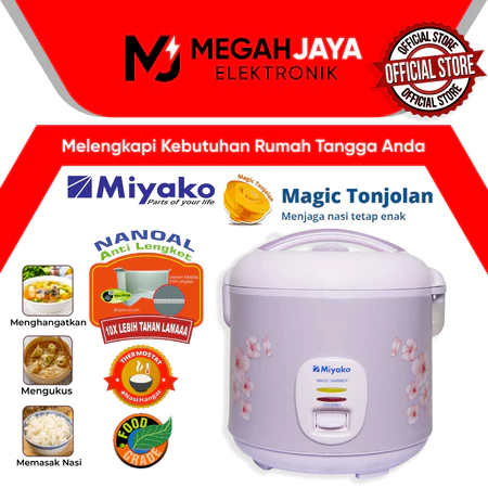
MIYAKO RICE COOKER / MAGIC COM / MCM
Rp. 261.500
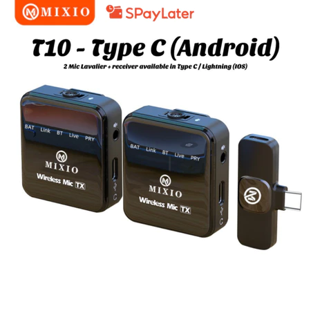
MIXIO-T9/T10 Wireless Microphone Pro
Rp. 243.000

IZARABATIK - Keyla Dusty Pink Set Ke
Rp. 53.000