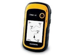
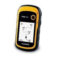

Garmin eTrex-10
Perhatian!
Spesifikasi Garmin eTrex-10
Gps Etrex 10
Only Garmin could make the eTrex better. The new eTrex 10 retains the core functionality, rugged construction, affordability and long battery life that made eTrex the most dependable GPS device available. We improved the user interface and added a worldwide basemap, paperless geocaching and added support for spine mounting accessories. You’ll recognize the name. You’ll recognize the quality. But the eTrex 10 is an entirely new device – a device that only Garmin could offer.
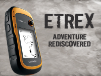
See The Way
eTrex 10 has an enhanced 2.2 in monochrome display that’s easy to read in any lighting situation. Both durable and waterproof, eTrex 10 is built to withstand the elements. Its easy-to-use interface means you’ll spend more time enjoying the outdoors and less time searching for information. eTrex 10 features the legendary toughness that’s built to withstand the elements – be it dust, dirt, humidity or water, none of which are a match for this storied navigator.
Find Fun
eTrex 10 supports geocaching GPX files for downloading geocaches and details straight to your unit. Visit OpenCaching.com to start your geocaching adventure. By going paperless, you're not only helping the environment but also improving efficiency. eTrex 10 stores and displays key information, including location, terrain, difficulty, hints and descriptions, which means no more manually entering coordinates and paper print outs. Simply upload the GPX file to your unit and start hunting for caches.
Keep Your Fix
With its high-sensitivity, WAAS-enabled GPS receiver and HotFix® satellite prediction, eTrex 10 locates your position quickly and precisely and maintains its GPS location even in heavy cover and deep canyons. The advantage is clear — whether you’re in deep woods or just near tall buildings and trees, you can count on eTrex 10 to help you find your way when you need it the most.
Go Global
The new eTrex series is the first-ever consumer-grade receivers that can track both GPS and GLONASS satellites simultaneously. GLONASS is a system developed by the Russian Federation that will be fully operational in 2012. When using GLONASS satellites, the time it takes for the receiver to “lock on” to a position is (on average) approximately 20 percent faster than using GPS. And when using both GPS and GLONASS, the receiver has the ability to lock on to 24 more satellites than using GPS alone.
Specifications :
Physical & Performance: |
|
| Unit dimensions, WxHxD: | 2.1" x 4.0" x 1.3" (5.4 x 10.3 x 3.3 cm) |
| Display size, WxH: | 1.4" x 1.7" (3.6 x 4.3 cm); 2.2" diag (5.6 cm) |
| Display resolution, WxH: | 128 x 160 pixels |
| Display type: | transflective, monochrome |
| Weight: | 5 oz (141.7 g) with batteries |
| Battery: | 2 AA batteries (not included); NiMH or Lithium recommended |
| Battery life: | 25 hours |
| Waterproof: | yes (IPX7) |
| Floats: | no |
| High-sensitivity receiver: | yes |
| Interface: | USB |
Maps & Memory: |
|
| Basemap: | yes |
| Preloaded maps: | no |
| Ability to add maps: | no |
| Built-in memory: | no |
| Accepts data cards: | no |
| Waypoints/favorites/locations: | 1000 |
| Routes: | 50 |
| Track log: | 10,000 points, 100 saved tracks |
Features & Benefits: |
|
| Automatic routing (turn by turn routing on roads): | no |
| Electronic compass: | no |
| Touchscreen: | no |
| Barometric altimeter: | no |
| Camera: | no |
| Geocaching-friendly: | yes (paperless) |
| Custom maps compatible: | no |
| Photo navigation (navigate to geotagged photos): | no |
| Outdoor GPS games: | no |
| Hunt/fish calendar: | yes |
| Sun and moon information: | yes |
| Tide tables: | yes |
| Area calculation: | yes |
| Custom POIs (ability to add additional points of interest): | yes |
| Unit-to-unit transfer (shares data wirelessly with similar units): | no |
| Picture viewer: | no |
| Garmin Connect™ compatible (online community where you analyze, categorize and share data): | yes |
dirta jaya survey
DIRTA JAYA SURVEY
adalah penjualan, alat survey. Kami disini sebagai supplier alat survey tanah atau bangunan, alat survey telekomunikasi, alat survey geologi atau mining, dan alat survey lainnya diantaranya Total Station, Digital Theodolite, Automatic Level, GPS, Kompas, Binoculars, Monocullars, Laser Rangefinder, Teropong Malam, Digital Altimeter, Clinometer, Tandem, Digital Planimeter, Distometer Speed Gun, Measuring Wheel, Measuring Tape, Grounding Tester, HT Handy Talky, Sound Level Meter, dan alat alat Geologi. Ditunjang dengan merk merk yang sudah terkenal dan telah diakui keberadaanya didunia survey diantaranya Topcon, Nikon, Sokkia, Garmin, Trimble, Magellan, Suunto, Horizon, Bushnell, Brunton , Leica, Bosch, South, Yamayo, Tajima, Icom, Kyoritsu, dll. Semoga keberadan kami dapat menjawab sekaligus memenuhi kebutuhan alat survey yang keberadaannya sangat dibutuhkan pada era perkembangan pembangunan dan tekhnologi pada saat ini


Produk Lainnya


Produk Sponsor
Proyektor mini Proyektor LED Proyekt
Rp. 111.750
Mesin Buang Asap Kipas Knalpot Asap
Rp. 693.000

Elementmax Mesin Pembersih Emas Pera
Rp. 434.000
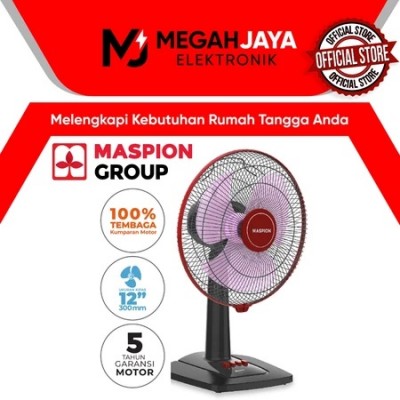
MASPION DESK FAN / KIPAS ANGIN EX307
Rp. 284.000
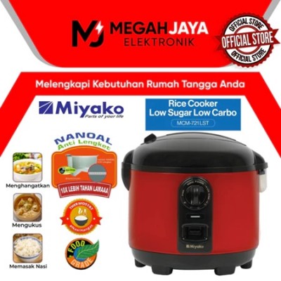
MIYAKO RICE COOKER / MAGIC COM LOW S
Rp. 274.500