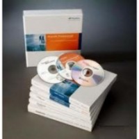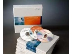
MapInfo Professional v12.0
Perhatian!
Spesifikasi MapInfo Professional v12.0
Cartographic output
MapInfo Professional v12.0 provides greater control over the appearance of scalebars allowing transparent backgrounds and borders, giving more space for map display. Enhancements to the Legend Designer introduced in v11.5 provide control over the order of objects within a frame, automatic word wrapping for long text and resizing of style swatches for individual layers. Objects within the layout window can now be quickly aligned.
Labelling
MapInfo Professional v12.0 delivers substantial improvements to the creation and placement of labels, reducing the need to create custom labels. New smart algorithms allow users to place more curved labels on a map automatically. Options are also provided to fall back to rotated labels where lines are too jagged or curved labels will not fit. Curved labels can now be moved by clicking and dragging them to a new location.
New algorithms provide intelligent placement of labels for polygons, automatically determining the best location and size for individual labels on densely populated maps. This combined with new automatic callout placement and the ability to set the priority of labelled layers within a map provides a set of comprehensive and flexible labelling options.
Ease of use
MapInfo Professional v12.0 continues to be the world’s most powerful easy to use GIS. New tools such as Compare Table Structure which allows users to compare and edit data in multiple tables simultaneously, the new PolyBuilder tool for automatically creating polygons from digitized linework and the new Quick Translator tool for getting non-native data in and out of MapInfo Professional, mean complex operations are made straightforward, saving valuable time.
Technology updates
With support for Windows 8 and Windows Server 2012, MapInfo Professional v12.0 allows organisations to make use of the latest hardware and software available. Users are now also able to read, write and create SQLite databases allowing seamless interoperability with the range of Autodesk products. The inclusion of the new Quick Translator makes getting data in and out of MapInfo Professional easier than ever. MapInfo Professional v12 also adds support for PostGIS 2.0, adds improved support for SQL Server Geography type and support for WFS v1.1.
In product notifications
MapInfo Professional v12.0 allows you to keep up-to-date with the latest MapInfo news and events through the inclusion of an in-product notification system. The new reader inside MapInfo Professional will automatically check for and retrieve notifications of important information such as patch releases and updates, thought leadership articles and license expiry notifications.
With MapInfo® Professional v12.0 we make it even easier to visualize potential whether it's customer analysis, the ideal location for a new bank branch, or assessing insurance risk. MapInfo Professional v12.0 key features include:
- Ekstensif meningkatkan kemampuan pelabelan membuatnya lebih cepat dan lebih mudah untuk membuat peta tampak hebat.
- Perbaikan opsi tampilan scalebar, termasuk latar belakang transparan.
- Pencetakan lebih mudah untuk skala kartografi tertentu, perbaikan lebih lanjut ke jendela Legenda Kartografi dan perbaikan Layout jendela.
- Peningkatan akses data di berbagai bidang: Dukungan untuk PostGIS v2.0 dan SQLite. Peningkatan dukungan untuk Microsoft SQL Server ®. Dukungan untuk WFS v1.1 dan yang lebih ditingkatkan Quick Translator baru untuk mengimpor / mengekspor format data spasial.
- Alat PolyBuilder baru untuk dengan mudah membuat poligon dari garis yang digital.
- Dukungan untuk Microsoft Windows ® 8.
Bagi Anda menggunakan versi lama dari MapInfo Profesional di sini adalah beberapa perangkat tambahan besar dari versi terbaru:
- Sebuah semua baru Legenda jendela Designer untuk penciptaan cepat dan mudah legenda kartografi yang indah untuk jendela peta Anda.
- Sebuah semua baru Legenda jendela Designer untuk penciptaan cepat dan mudah legenda kartografi yang indah untuk jendela peta Anda.
- Peningkatan penggunaan RAM (memori komputer) ketika berjalan pada sistem Windows 64 bit.
- Cari Data katalog dari seluruh dunia dengan built in Katalog Browser.
- Dibangun pada akses ke Microsoft ® Bing citra lapisan dan server genteng lainnya.
- Berbagi peta Anda dengan sebagai Geo-terdaftar file PDF.
- Sebuah semua baru Tabel Daftar jendela untuk akses cepat ke banyak perintah dan operasi mudah pada beberapa tabel.
- Integrasi dengan solusi lain dari Suite GIS MapInfo termasuk peta penerbitan untuk pengguna web melalui Stratus MapInfo dan integrasi dengan MapInfo Manager untuk mempertahankan organisasi perpustakaan Anda dari data spasial.
- Cobalah gratis selama 30 hari! Ambil MapInfo Professional v12.0 dan mencoba semua fitur baru
- Download Brochure MapInfo Professional v12.0
PT.Geosurveying
Alat Barat. Excavator. Khobelco.Traktor.Bomag.Vibro.
Demikianlah sekelumit tentang kami
dan anda bisa hub kami 082148955545
