
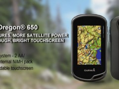
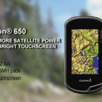

GPS Garmin Oregon 650
Gambar Produk
GPS Garmin Oregon 650
Brand
Garmin
Minimum Pembelian
1 unit
Maximum Pembelian
100 unit
Pengiriman
1 Hari Setelah Pembayaran
Lokasi
Harga
Rp. 44
Dilihat Sebanyak
218 kali
Update Terakhir
10-06-2016
Bagikan
+ Penawaran
Perhatian!
Perusahaan ini terdaftar sebagai Free Member. Hindari melakukan pembayaran sebelum bertemu penjual atau melihat barang secara langsung. COD (Cash On Delivery) atau bertemu langsung dengan penjual merupakan metode transaksi lebih aman.
Spesifikasi GPS Garmin Oregon 650
Garmin Gps Map Oregon 650
Physical & Performance:
Unit dimensions, WxHxD 2.4 " x 4.5 " x 1.3 " ( 6.1 x 11.4 x 3.3 cm)
Display size, WxH 1.5 " W x 2.5 " H ( 3.8 x 6.3 cm) ; 3 " diag ( 7.6 cm)
Display resolution, WxH 240 x 400 pixels
Display type transflective color TFT touchscreen
Weight 7.4 oz ( 209.8 g) with batteries
Battery rechargeable NiMH pack ( included) or 2 AA batteries ( not included) ; NiMH or Lithium recommended
Battery life 16 hours
Waterproof Yes ( IPX7)
Floats No
High-sensitivity receiver Yes
Interface high-speed USB and NMEA 0183 compatible
Maps & Memory:
Basemap Yes
Preloaded maps no
Ability to add maps Yes
Built-in memory 3.5 GB
Accepts data cards microSD™ card ( not included)
Waypoints/ favorites/ locations 4000
Routes 200
Track log 10, 000 points, 200 saved tracks
Features & Benefits:
Automatic routing ( turn by turn routing on roads) Yes ( with optional mapping for detailed roads)
Electronic compass Yes ( tilt-compensated 3-axis)
Touchscreen Yes
Barometric altimeter Yes
Camera yes ( 8 megapixel with autofocus; digital zoom)
Geocaching-friendly
Yes ( Paperless)
Custom maps compatible
Yes
Photo navigation ( navigate to geotagged photos) Yes
Hunt/ fish calendar Yes
Sun and moon information Yes
Tide tables Yes ( with optional Bluechart)
Area calculation Yes
Custom POIs ( ability to add additional points of interest) Yes
Unit-to-unit transfer ( shares data wirelessly with similar units) Yes ( plus images and custom maps)
Picture viewer Yes
Garmin Connect™ compatible ( online community where you analyze, categorize and share data) Yes
Toko Peralatan Survey
CV.BUANA SURVEY
081333102011 atau 021.7321129 ( Nurcahyo)
Menjual Alat Ukur / Alat Survey,Gps Garmin, Gps Trimble, Fluke, Kyoritsu, Hioki, Sanwa, Brunton, Suunto, Sincon, Nikon, Topcon, South, Motorola, Alinco, Icom, Kyoritsu Dan Fluke.Perusahaan Di Bawah Naungan Buana Survey Group,
Menjual,Service Kilibrasi, Alat-Alat Untuk Survey Pemetaan,Kontraktor,Telekomunikasi,Geologi, Exploration ,Kelautan, Militer,Migas, Meteorologi, Klimatologi, dan Geofisika, Laboratorium Industri Pembangunan Pembangunan, Pengelolahan Lahan Lahan Perhutanan Dan Perkebunan Kelapa Sawit. Diantara Alat-Alatnya Sebagai Berikut :
Total Station :
-Total Station Sokkia CX-101, CX-102, CX-103, CX-105, CX-105c
-Total Station Sokkia FX-101, FX-102, FX-103, FX-105
-Total Station Topcon GTS-102N, GTS-255N, GTS-250 Series
-Total Station Topcon ES-101, ES-102, ES-103, ES-105
-Total Station Topcon OS-101, OS-102, OS-103, OS-105
-Total Station Nikon DTM-322, NPL322
-Total Station Nikon Nivo 1M, 2M,3M, 5M
-Total Station Gowin TKS 202
-Total Station Cygnus KS-102
-Total Station South NTS-352L
-Total Station Hi-Target ZTS-320R
-Total Station Ruide RTS 822A, 822R
-Total Station GEO FENNEL FTS 102 , FTD 02
Digital Theodolite :
- Geo FENNEL FET 102KL
- Sokkia DT-540,DT-740
- Topcon DT-205,DT-205L,DT-209,DT-209L
- Nikon NE-100,NE-101,NE-102,NE-103
- South ET-02
- My Surv DT-202C
- GeoMAX ZIPP-02
- Ruide ET02
- Pentax ETH-502
Automatic Level :
- Sokkia B-20,B-30,B-40
- Topcon ATB-2,ATB-3,ATB-4
- Nikon AS-2C,AE-7,AP-8,AC-2S,AX-2S
- Digital Level Orion 2LS
- Digital Level GEOMAX ZDL700
- Digital Level PENTAX AP228
- Digital GEO FENNEL FAL 32
GPS Handheld:
– Garmin GPSMAP 62s
– Garmin GPSMAP 78s
– Garmin GPS Montana 650 kamera 5 MP
– Garmin GPS e-Trex 10,20,30
– Garmin GPS Rino 610– Garmin Nuvi 1350,Nuvi 50LM,
– Garmin GPS Aera 500,Aera 550
– Magellan Explorist 610
Gps Marine :
– Garmin GPSMAP 4012
– Garmin GPSMAP 2108
– Garmin GPSMAP 585
– Garmin GPS 128
– Garmin Radar GMR-18
– Garmin GSD 22
– Garmin Antena GA 30
– Garmin Kabel Transduser
– Garmin Fishfinder Echo 100,300c,500c
– FURUNO GP-32
– FURUNO FCV 620
– FURUNO FCV 627
– FURUNO 1835
– Gps Geodetik Trimble,Topcon,Sokkia,Javad
– Kompas Geologi,Kompas Survey
– Handy Talky
– Radio Rig
– Telepon Satelit
– Walkie Talkie Sepasang
– Teropong Binocular Nikon
– Teropong Binocular Bushnell
– Teropong Malam Night Vision
– Teropong Jarak Bushnell&Nikon;- Peralatan Geologi Explorasi Tambang
– Peralatan Meteorologi
– Peralatan Hidrografi Laut Dan Sungai
– Peralatan Survey Hutan Dll
Tersedia Jasa Service Kalibrasi
Diantaranya :
Total Station - Theodolite - Automatic Level / Waterpass dan Laser level dll
* GRATIS ONGKOS KIRIM !!!! WILAYAH DKI JAKARTA PEMBAYARAN COD DI TEMPAT *

Free Member
jalan muchtar raya no 1d kreo-ciledug
Login Terakhir 18-01-2017
081333102011
081333102011


Produk Lainnya


Produk Sponsor

Tefal Wajan Anti Lengket / Penggoren
CALL
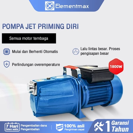
Pompa air Otomatis/Mesin Pompa Air/P
Rp. 607.000
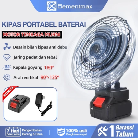
Kipas listrik nirkabel 8 inci dengan
Rp. 203.000

Tefal Cook & Clean Frypan Series 20
CALL
COSMOS WALL FAN / KIPAS ANGIN DINDIN
Rp. 275.500